


Skip to content
Esoteric Strats

Mafuriko · Climate and public safety

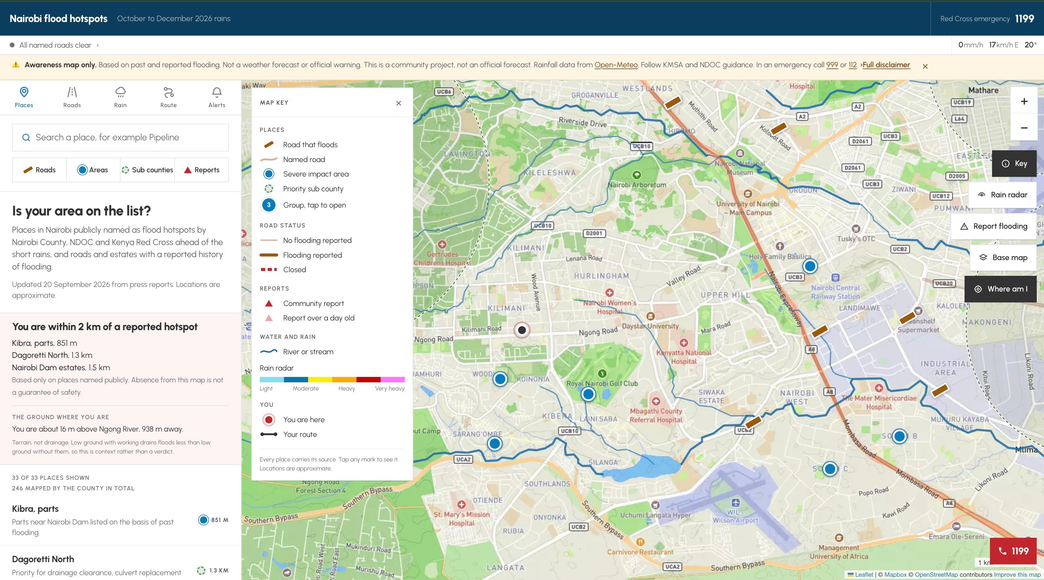
Nairobi's flood awareness map.

Reported hotspots, rainfall, road closures and community reports on one map. Every community report is verified by the team before it goes live. Built with AIVERSE.

Nairobi's flood awareness map.: screenshot
01
55,000+
Visits since launch.
02
Verified
Community reports checked before they publish.
03
One map
Hotspots, rain, roads and reports together.
01The problem

The problem

The warnings exist. They are just scattered. Flood prone areas are named in county statements, press briefings and news reports, and few people read all of them before they leave home.

02What we built

What we built

Mafuriko puts Nairobi's reported flood hotspots, rainfall and road closures on one map, free, on any phone. It is built for residents, not analysts: anyone can check their area or report flooding in a few taps.

  • 01

    Report flooding

    A short form with location, what is happening and an optional photo. Reports wait for verification.

  • 02

    Check your area

    Search a place to see nearby hotspots, rainfall and affected roads, with layers you can switch on and off.

Mafuriko is an awareness map, not a forecast. AIVERSE, our AI practice, powers the AI and data behind it.

03The result

55,000+visits since launch

More than 55,000 visits since launch.

More work

Other projects.

RACIDA Ethiopia · Humanitarian and development

A national NGO website, with its own CMS.

A full website for a humanitarian organisation working in Ethiopia's arid and semi arid lands. Programmes, projects, partners and stories, all edited in house by RACIDA's own team.

What’s slowing your team down?

Walk us through it. We’ll come back with what a fix could look like, and what it would take.